The question of whether boundary surveys are public record doesn’t have a simple yes-or-no answer, and understanding the distinction could save you thousands in property disputes or derailed real estate transactions. Most boundary surveys themselves remain private documents between property owners and surveyors, but the plat maps and legal descriptions derived from these surveys typically become public record once filed with your county recorder’s office. This accessibility varies dramatically by jurisdiction, with some counties offering free online access while others require in-person visits and copying fees.
For homeowners and real estate professionals, knowing how to access these records directly impacts property valuations, title insurance requirements, and dispute resolution strategies. Whether you’re conducting due diligence on a potential purchase, resolving a fence-line disagreement with neighbors, or simply verifying your property boundaries, understanding what survey information is publicly available versus what requires authorization from the property owner is essential. The privacy of your own survey data also depends on whether it’s been officially recorded, affecting everything from your negotiating position in sales to your vulnerability in boundary disputes.
Understanding Boundary Surveys: What They Are and Why They Matter
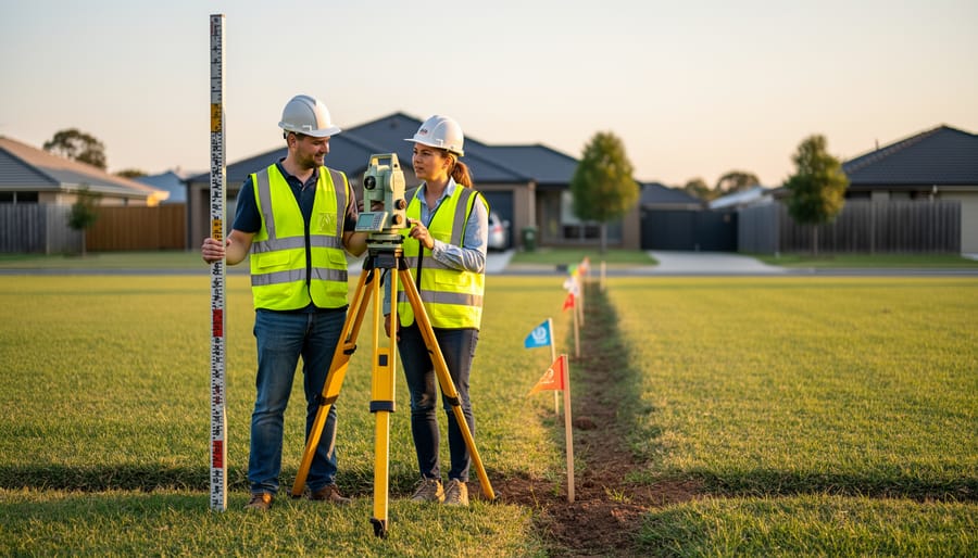
A boundary survey is a precise measurement and mapping of your property’s legal boundaries, conducted by a licensed surveyor who uses specialized equipment to determine exactly where your land begins and ends. Think of it as a professional fact-finding mission that creates an official record of your property lines, documenting corners, edges, and any encroachments that might affect your ownership rights.
The primary purpose of a boundary survey is straightforward: to eliminate guesswork about property ownership. These surveys identify the exact location of property lines based on legal descriptions in your deed, historical records, and physical markers on the ground. A surveyor will locate monuments, stakes, or other markers and create a detailed map showing your property’s precise dimensions and relationship to neighboring parcels.
What sets boundary surveys apart from other property surveys? While an ALTA survey provides comprehensive details for commercial transactions and includes improvements, easements, and title information, a boundary survey focuses exclusively on establishing property lines. Similarly, a topographic survey maps elevation changes and land features, while a boundary survey zeroes in on ownership boundaries.
Real-world scenarios make the value crystal clear. Before installing a fence, you need to know you’re building on your land, not your neighbor’s. During a home purchase, your lender or title insurance company may require verification of boundaries to protect their investment. When property boundary disputes arise with neighbors, a boundary survey provides the definitive evidence needed for resolution. Even simple projects like adding a deck or shed require certainty that you’re respecting setback requirements and staying within your legal boundaries.
The Public Record Question: What’s Actually Available
Survey Plats vs. Private Survey Reports
Understanding the difference between survey plats and private survey reports is essential when determining what’s publicly accessible. These two documents serve different purposes and have distinct privacy statuses.
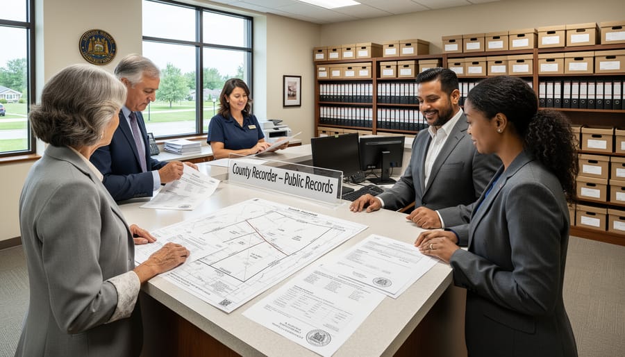
Survey plats are official maps that subdivide land into lots, blocks, or parcels. When developers create new subdivisions or when land is formally divided, they must file these plats with the county recorder’s office. Once recorded, these become permanent public records that anyone can access. They show property boundaries, easements, streets, and other important features that affect multiple properties in a development. Real estate professionals regularly consult these when evaluating properties for clients.
Private survey reports, on the other hand, tell a different story. When you hire a surveyor to locate your property corners or resolve a boundary question, that surveyor creates a report specifically for you. This document remains your private property unless you choose to record it with the county. Most homeowners never record their private surveys, meaning these detailed reports stay confidential.
Here’s the practical distinction: if you’re researching a property’s boundaries, you’ll likely find the original subdivision plat at the recorder’s office, but you won’t find surveys that previous owners commissioned privately. From a due diligence perspective, this means ordering your own current survey often makes more financial sense than hoping to access someone else’s. For insurance and financing purposes, lenders typically require fresh surveys anyway, ensuring you have accurate, up-to-date boundary information that protects your investment and helps avoid costly disputes down the road.

What Gets Recorded and Where
When a boundary survey is completed, several key documents may enter the public record system, though what gets filed varies significantly by location. The survey plat or map—the visual representation of property boundaries—is typically the primary document recorded with your county recorder’s office or land registry. This plat shows boundary lines, measurements, monuments, easements, and the surveyor’s certification.
Many jurisdictions require survey plats to be filed whenever property changes hands or is subdivided, making them accessible through county land records. However, surveys commissioned for private purposes, like pre-purchase inspections or fence installation, may never be officially recorded unless the property owner chooses to file them.
Municipal planning departments often maintain copies of surveys related to building permits, zoning applications, or subdivision approvals. These departments create another access point for survey information, particularly for newer developments or properties with recent construction activity.
To access these records, start with your county recorder’s office website—most now offer online portals where you can search by address or parcel number. Many systems display scanned documents directly, though some charge nominal fees for copies. If online access isn’t available, visit the recorder’s office in person or call to request specific documents.
For real estate professionals, accessing historical surveys during due diligence can uncover easements or encroachments that impact property value and insurability. Title insurance companies often require current surveys precisely because boundary disputes can trigger costly claims. Understanding where surveys are stored helps you proactively identify potential issues before they become expensive problems at closing.
State-by-State Variations in Survey Recording Laws
Survey recording laws vary significantly across the United States, creating a patchwork of requirements that can impact your ability to access boundary information. Some states mandate recording, making surveys readily available as public records, while others leave it optional, creating potential information gaps.
States like California, Florida, and Texas generally require recorded surveys for certain transactions, particularly subdivision plats and major boundary adjustments. These mandatory filing states offer easier access to survey data through county recorder offices, benefiting homebuyers conducting due diligence and real estate professionals advising clients.
Conversely, states such as Pennsylvania and Ohio treat most boundary surveys as optional records. Property owners in these jurisdictions may choose whether to file their surveys publicly, meaning you might need to request information directly from previous owners or their surveyors.
This variation has real implications for your property investment strategy. In states with robust recording requirements, title insurance companies can more easily verify boundaries, potentially reducing premiums. Where recording is optional, expect additional due diligence costs and possible coverage limitations. Understanding your state’s specific requirements helps you budget appropriately for property transactions and protects against boundary disputes that could affect property values.
How Survey Records Relate to Property Easements and Boundaries
When Survey Records Protect Your Property Rights
Public survey records serve as your first line of defense in several common property scenarios. When neighbors dispute a fence line, accessing the county’s recorded plat or boundary survey can provide definitive evidence of the actual property line, potentially saving thousands in legal fees. These documents become invaluable during property due diligence, allowing prospective buyers to verify that structures, driveways, and improvements sit entirely within property boundaries before closing.
Easement verification represents another critical application. Accessing historical surveys can confirm whether utility companies, municipalities, or neighbors hold legitimate access rights across your property, information that directly impacts property value and insurance coverage. Real estate investors routinely review these records to identify encroachments that might complicate resale or trigger title insurance claims.
One homeowner discovered through public records that their garage encroached two feet onto neighboring land, information that emerged before listing their property and allowed for proactive resolution. Such scenarios underscore why integrating survey record review into your property acquisition strategy protects both your investment and future insurability.
What Neighbors Can (and Cannot) Learn About Your Property
When boundary surveys become public record, neighbors can access property line measurements, lot dimensions, and the surveyor’s findings about where your land begins and ends. This information is fairly straightforward—it shows boundaries, easements, and potentially any encroachments between properties.
However, here’s what remains private: your survey doesn’t reveal your home’s interior layout, financial information, mortgage details, or purchase price. While your neighbor might learn that your fence sits two feet over the property line, they won’t discover what you paid for the property or your insurance coverage details.
Understanding this distinction matters for real estate professionals advising clients and homeowners concerned about privacy. The survey itself is a technical document focused solely on physical boundaries, not personal or financial data. Most privacy concerns stem from misconceptions about what surveys actually contain.
From an insurance perspective, knowing that boundary information is accessible can actually benefit property owners. If a dispute arises, both parties can reference the same public documentation, potentially avoiding costly legal battles. Real estate transactions also benefit from this transparency—buyers can independently verify property lines before closing, reducing post-purchase surprises that might affect property value or insurability.
The key takeaway: boundary surveys reveal spatial facts about your property, not private details about your life or finances.
How to Access Boundary Survey Records in Your Area
Online Resources and County Recorder Offices
Most county recorder offices now offer convenient online access to public records, including boundary surveys, through their official websites. These digital portals typically feature searchable databases where you can look up property information using an address, parcel number, or owner’s name. Many counties have invested in Geographic Information System (GIS) platforms that display property boundaries, survey markers, and recorded plat maps through interactive mapping tools. These online resources are often free or available for nominal document retrieval fees, making them your first stop for survey research.
However, not all surveys appear online, particularly older documents or those filed before digital conversion projects. When online searches come up empty, an in-person visit to the county recorder’s office becomes necessary. Office staff can help you navigate archived records, microfilm collections, and physical survey books that haven’t been digitized. This is especially valuable when you’re conducting thorough due diligence before a property purchase or need certified copies for insurance claims or boundary dispute resolution.
For real estate professionals, establishing familiarity with your local recorder’s online systems streamlines transaction processes and helps clients make informed decisions. Knowing when digital resources fall short and personal visits become worthwhile saves time and prevents costly oversights during property transfers.
Costs and Timeline for Obtaining Survey Documents
Accessing public boundary surveys typically involves minimal costs, though fees vary by jurisdiction. Most county recorder offices charge between $1 to $5 per page for copies, with some offering free digital access through online portals. If you need certified copies for legal proceedings or refinancing, expect to pay $10 to $25 per document. Online database searches are often free, though printing or downloading may incur small fees.
The timeline depends on your access method. Online databases provide instant results if available in your area. In-person or mail requests usually take 3 to 10 business days, though rural counties with limited staff might need two weeks. For homebuyers, plan ahead during your due diligence period to avoid closing delays. If public records don’t yield results, hiring a licensed surveyor costs $300 to $1,000 but ensures accuracy and may be necessary for title insurance requirements or resolving boundary disputes with neighbors.
When You’ll Need to Commission a New Survey
While public records can provide valuable boundary information, certain situations demand a fresh professional survey. If you’re planning construction, additions, or installing fences near property lines, lenders and municipalities typically require current surveys—often no older than six months. Existing public records may be outdated, especially if neighboring properties have changed or natural landmarks have shifted.
Property disputes almost always necessitate new surveys, as courts require licensed surveyors to provide expert testimony based on current field measurements. Similarly, when purchasing unimproved land or properties without recent surveys, your title insurance company may require one to identify potential encroachments or easement issues that could affect your investment.
Costs vary significantly by location and property complexity, ranging from $300 to $1,000 for residential lots, with larger or irregular parcels commanding higher fees. While this represents an upfront expense, commissioning a proper survey protects your real estate investment by preventing costly boundary disputes and ensuring your property insurance accurately reflects what you own. Consider it essential due diligence that pays dividends in long-term financial security.
Privacy Concerns and Protecting Your Property Information
While boundary surveys are generally public records, legitimate privacy concerns exist when it comes to your property information being accessible to anyone. Understanding what’s protected and what strategies you can employ helps balance transparency with personal security.
Most boundary surveys reveal physical property measurements, lot dimensions, and easement locations, but they typically don’t include sensitive personal details like your social security number, financial information, or specific security system layouts. Personal identifying information beyond basic ownership names is usually redacted or stored separately from publicly accessible survey documents.
However, surveys do show property configurations, building placements, and potential access points, which some homeowners find concerning from a security standpoint. Your property ownership rights are documented publicly by necessity, but you can take protective measures.
Consider requesting that detailed site improvements, high-value landscaping features, or specific utility locations be noted on private copies rather than recorded versions. When commissioning new surveys, discuss with your surveyor which details must be filed publicly versus what can remain in your personal records.
For insurance purposes, maintain your own comprehensive property documentation separate from public records. This protects sensitive information about security features, valuable improvements, or unique property characteristics that inform your coverage needs without broadcasting them publicly.
If privacy concerns are significant, consult with a real estate attorney about your jurisdiction’s disclosure requirements. Some areas allow limited access restrictions for legitimate security reasons, particularly for high-profile properties or those with unique vulnerability concerns.
Why This Matters for Real Estate Transactions and Insurance
Understanding whether boundary surveys are public record directly impacts some of the most significant financial decisions you’ll make in real estate transactions. For buyers, accessing previous surveys during due diligence can save thousands of dollars by identifying potential boundary disputes, encroachments, or easements before closing. These documents become essential when asking the right questions before purchasing a property.
From a title insurance perspective, survey accessibility plays a crucial role in risk assessment. Title insurance companies rely on survey information to identify potential exceptions to coverage, such as encroachments or boundary discrepancies that could lead to future claims. When surveys are readily available as public records, insurers can more accurately price policies and homeowners gain clearer insight into what their coverage includes or excludes.
For mortgage lenders, survey records provide essential verification of property boundaries and improvements. Many lenders require current surveys before approving property loans, particularly for commercial real estate or properties with complex boundaries. Public access to historical surveys helps lenders evaluate whether additional surveying costs are necessary or if existing records suffice.
Real estate investors particularly benefit from survey record accessibility when conducting portfolio analysis or evaluating multiple properties. Quick access to boundary information streamlines the due diligence process and helps identify potential red flags before committing capital. Additionally, in markets where surveys aren’t publicly available, the cost of obtaining private surveys becomes a necessary line item in investment calculations, affecting overall returns. This accessibility ultimately promotes transparency in real estate markets, allowing all parties to make more informed decisions backed by concrete boundary data rather than assumptions or outdated information.
The public accessibility of boundary surveys isn’t a simple yes-or-no answer. As we’ve explored, it depends heavily on your local jurisdiction, whether the survey was officially recorded, and the specific policies governing property records in your area. While some surveys become part of the permanent public record once filed with county offices, others remain private documents between property owners and surveyors.
For homeowners and prospective buyers, understanding these distinctions matters more than you might think. Accessing survey information can prevent costly boundary disputes, inform your title insurance decisions, and provide crucial due diligence protection during property transactions. The good news is that even when surveys aren’t publicly available, alternatives exist—from requesting copies from sellers to ordering new surveys that can protect your investment.
Your next steps should be straightforward: contact your local county recorder or assessor’s office to understand their specific policies, ask sellers for existing surveys during the buying process, and consider the modest investment in a new boundary survey as insurance against future headaches. Remember, in real estate, knowledge about property lines isn’t just power—it’s financial protection. Taking time now to verify boundaries can save thousands in legal fees and preserve both your property value and peace of mind down the road.