A single flooding event can wipe out millions in property value, yet most real estate decisions still rely on outdated flood maps and gut instinct. The difference between properties that maintain value and those that become uninsurable often comes down to one factor: whether stakeholders used actual flood data to guide their choices.
Data-driven decision making in flood risk management means analyzing historical flood patterns, rainfall trends, elevation data, and climate projections before buying, developing, or insuring property. When a Portland developer used hydrological modeling to avoid building in a statistically risky zone, they saved $3.2 million that competitors lost two years later during unprecedented flooding. When a Houston homeowner checked granular flood data before purchasing, they discovered their “low-risk” target property had flooded three times in fifteen years—information the seller conveniently omitted.
The financial stakes are staggering. Insurance premiums in high-risk flood zones have increased 400% in some markets over the past decade. Mortgage lenders now reject applications in previously acceptable areas based on advanced risk modeling. Municipalities face bankruptcy from inadequate infrastructure planning. Yet the tools to make smarter decisions—from FEMA databases to private risk assessment platforms—are more accessible than ever.
This article examines real-world examples across five critical stakeholder groups: property developers who used terrain analysis to maximize ROI, insurance companies that rebuilt their underwriting models, mortgage lenders implementing new risk thresholds, municipalities that saved taxpayers millions through predictive analytics, and homeowners who protected their investments with simple data checks. Each example demonstrates measurable outcomes, revealing how data transforms flood risk from an abstract threat into a manageable variable in property decisions.
What Data-Driven Decision Making Means for Flood Protection
Data-driven decision making in flood protection means using concrete numbers, patterns, and analytics to guide choices about property development, insurance coverage, and risk mitigation rather than relying on gut feelings or outdated assumptions. Think of it as upgrading from a paper map to GPS navigation—you’re still trying to reach the same destination, but with far more accurate, real-time information guiding your route.
Traditionally, flood management operated on historical precedent and reactive measures. A community would experience flooding, build levees or barriers in response, and hope for the best. This approach often left property owners, insurers, and municipalities blindsided by changing weather patterns and evolving risk profiles. Modern analytics-based approaches flip this script entirely, using predictive modeling and comprehensive data analysis to anticipate problems before they occur.
Today’s flood risk assessments draw from multiple data streams working in concert. Historical flooding records reveal patterns spanning decades, showing which areas flood repeatedly and under what conditions. Weather pattern data, including precipitation trends and storm intensity forecasts, help predict future risks with increasing accuracy. Topography data maps elevation changes down to the foot, identifying natural drainage paths and potential pooling zones. Infrastructure data tracks everything from aging stormwater systems to new development projects that might alter water flow.
For property stakeholders, this data translation into actionable intelligence makes all the difference. Real estate professionals can guide clients away from high-risk properties or negotiate prices that reflect true flood exposure. Homeowners gain clarity about whether expensive mitigation measures will actually pay off. Insurance providers can price policies more accurately, while lenders better understand the long-term viability of mortgage collateral in flood-prone areas.
The shift represents more than just better technology—it’s a fundamental change in how we approach property risk. Instead of asking “Has this area flooded before?” data-driven approaches ask “What’s the probability of flooding over the next 30 years, and what will it cost?”
Real Estate Development: Building Smarter from the Ground Up
Houston’s Post-Harvey Development Revolution
Hurricane Harvey’s devastating 2017 impact forced Houston’s real estate development industry to fundamentally rethink how they approach site selection and construction. Today, forward-thinking developers are leveraging sophisticated data analytics to build communities that can withstand future flooding events while maintaining property values and insurability.
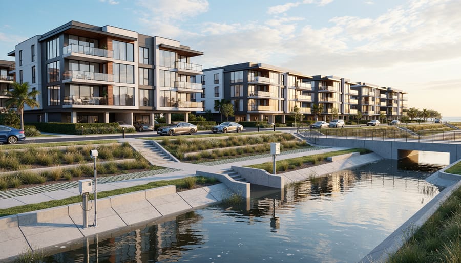
One standout example is the 1,200-acre Cypress Creek Lakes development in northwest Houston. Developer Friendswood Development Company integrated FEMA flood plain mapping with proprietary rainfall modeling and historical flood data dating back to 1935. The result? Every home sits at least three feet above the 500-year flood plain, compared to the standard one-foot elevation above the 100-year plain. During the 2019 Tropical Storm Imelda, which dumped 40 inches of rain on parts of Houston, the development experienced zero home flooding while surrounding neighborhoods suffered significant damage.
Similarly, the Memorial Heights redevelopment utilized LiDAR elevation data and Harris County Flood Control District watershed models to design a mixed-use community with integrated detention ponds and permeable surfaces. This data-driven approach reduced flood insurance premiums for homeowners by an average of 34 percent compared to nearby properties.
The financial impact is substantial. Properties in these data-informed developments maintain resale values 12-18 percent higher than comparable homes in traditional subdivisions, according to Houston Association of Realtors analysis. Lenders have taken notice too, offering preferential mortgage rates for homes in certified flood-resistant communities. This demonstrates how upfront investment in data analytics translates directly into long-term value protection and reduced insurance costs for homeowners.
Elevation Data That Changed Construction Codes
Coastal communities have discovered that precise elevation data can literally save lives and properties. LiDAR (Light Detection and Ranging) technology and digital elevation models have revolutionized how municipalities understand their flood vulnerability, leading to smarter building codes that reflect actual risk rather than outdated assumptions.
Take Miami Beach, Florida, where city planners used LiDAR data to create incredibly detailed elevation maps showing variations as small as a few inches. The data revealed that previous flood maps had significantly underestimated risk in certain neighborhoods. Armed with this information, the city updated its building codes in 2016, requiring new construction and substantial improvements to meet higher elevation standards. Properties in the most vulnerable areas now must be built at least two feet above base flood elevation, rather than the previous one-foot requirement.
Similarly, Norfolk, Virginia leveraged digital elevation models to identify streets and properties that would flood during routine tidal events, not just major storms. This granular data helped the city implement tiered elevation requirements based on specific location risk. New residential construction in high-risk zones must now be elevated an additional 18 inches beyond FEMA requirements.
The financial implications are significant. While building to these higher standards adds upfront construction costs (typically 3-7% of total project value), property owners benefit from substantially lower flood insurance premiums and reduced risk of catastrophic loss. Developers who initially resisted the changes now recognize these requirements as selling points, as buyers increasingly seek properties built to withstand tomorrow’s climate realities, not yesterday’s standards.
Insurance Companies Pricing Risk with Precision
FEMA’s Risk Rating 2.0 Transformation
In October 2021, FEMA revolutionized its National Flood Insurance Program by launching Risk Rating 2.0, marking a fundamental shift from outdated zone-based pricing to sophisticated, property-specific calculations. This transformation demonstrates data-driven decision making at scale, affecting approximately 5 million policyholders across the United States.
The old system relied heavily on broad flood zones, treating all properties within the same zone identically regardless of their unique characteristics. Risk Rating 2.0 now analyzes specific variables including a property’s elevation, distance from water sources, type of flooding risk, and reconstruction costs. This granular approach leverages advanced modeling that processes billions of data points to generate individualized premium rates.
The results reveal significant disparities in how flood insurance coverage is now priced. Properties previously grouped together now see dramatically different premiums based on actual risk. For example, a single-story home in coastal Florida sitting three feet above base flood elevation might see premiums decrease by 15 percent, while a similar home just blocks away at lower elevation could experience increases of 20 percent or more.
Real estate professionals report instances where two identical homes on the same street now carry premiums differing by several hundred dollars annually, simply because one sits eight feet closer to a retention pond. While controversial, this granular approach provides more accurate risk assessment, helping property buyers understand true flood exposure before purchase and encouraging mitigation investments that directly lower premiums.
Private Insurers Using Catastrophe Models
Leading reinsurance giants Swiss Re and Munich Re have revolutionized how the insurance industry approaches flood risk through sophisticated catastrophe modeling. These companies process massive datasets combining satellite imagery, historical weather patterns, topographical information, and infrastructure details to create granular risk assessments that would have been impossible just a decade ago.
Swiss Re’s CatNet platform exemplifies this data-driven approach. The system integrates climate projections with real-time property data to evaluate flood exposure at the individual address level. In one notable case study, Swiss Re used its models to analyze coastal properties in Miami-Dade County, identifying microzones where flood risk varied by as much as 300% within just a few city blocks. This precision allowed their insurance clients to price policies more accurately, reducing losses by 18% while maintaining competitive premiums for lower-risk properties.
Munich Re takes a similar approach with its NATHAN Risk Suite, which combines artificial intelligence with physical hazard models. During a 2022 analysis of commercial properties along the Mississippi River basin, Munich Re’s models predicted flood severity patterns that traditional FEMA maps missed entirely. The company incorporated factors like upstream dam conditions, soil saturation levels, and seasonal precipitation forecasts to create dynamic risk profiles. Properties initially classified as moderate risk were reclassified across five distinct risk tiers, leading to more appropriate coverage levels and preventing approximately $47 million in potential claim overpayments.
These insurers continuously refine their models by incorporating emerging data sources, including social media activity during flood events and IoT sensor networks that monitor water levels in real-time, ensuring their underwriting decisions remain cutting-edge.
Banking and Lending: Protecting Investments Through Analytics
Mortgage Underwriting with Climate Risk Integration
Major mortgage players are revolutionizing their underwriting processes by weaving climate risk data directly into loan decisions. Fannie Mae and Freddie Mac now require lenders to evaluate properties in Special Flood Hazard Zones more rigorously, going beyond traditional FEMA maps to include forward-looking flood projections that account for climate change.
Here’s how this plays out in practice: When a buyer applies for a mortgage on a coastal property in Miami, the lender now analyzes 30-year flood risk projections rather than just historical data. If the analysis shows increasing flood risk, the loan might require a larger down payment, higher interest rates, or mandatory flood insurance with specific coverage levels. Some lenders are declining applications altogether for properties in high-risk zones.
Bank of America and Wells Fargo have begun incorporating third-party climate risk analytics into their approval processes. For example, a seemingly low-risk property that sits outside current flood zones might face stricter terms if predictive models show it will likely fall within a flood zone by 2040. This data-driven approach protects lenders from future losses while encouraging buyers to consider community flood protection projects that can improve property resilience and potentially secure better loan terms.
Commercial Property Valuations Adjusted by Flood Data
Commercial lenders are fundamentally reshaping their underwriting processes by integrating sophisticated flood exposure analytics into property valuations. This data-driven approach has proven essential in protecting portfolios from climate-related losses while maintaining responsible lending standards.
Consider a regional bank evaluating a $2.5 million loan for a retail plaza in coastal Florida. Traditional appraisals suggested a 75% loan-to-value ratio, but when the lender overlaid FEMA flood maps with historical precipitation data and sea-level rise projections, they discovered the property faced a 40% increased flood probability over the next decade. The result? They adjusted the LTV to 65% and required the borrower to install flood barriers and elevation systems before closing, reducing potential exposure by nearly $250,000.
Major commercial lenders like Wells Fargo and JPMorgan Chase now routinely incorporate third-party flood risk scores into their underwriting software. These platforms analyze everything from watershed drainage patterns to climate change models, generating risk-adjusted valuations that inform lending decisions. Properties in high-risk zones often face LTV reductions of 5-15% compared to similar assets in lower-risk areas.
This analytical rigor benefits everyone involved. Borrowers gain clearer expectations about mitigation requirements upfront, lenders protect their capital reserves, and communities see property owners implementing flood defenses that reduce overall disaster costs.
Municipal Infrastructure: Cities Making Million-Dollar Decisions
Norfolk’s $1.5 Billion Data-Informed Resilience Plan
Norfolk, Virginia faced a critical challenge: as a coastal city experiencing some of the fastest sea level rise on the East Coast, it needed to protect 144,000 residents and billions in property value. Rather than implementing blanket solutions, the city developed a $1.5 billion resilience plan grounded entirely in data analysis.
The planning team integrated three key data sources: LiDAR flood modeling that mapped water flow patterns down to individual streets, NOAA sea level rise projections extending to 2100, and granular economic impact assessments showing potential property damage by neighborhood. This multilayered approach revealed something surprising—the most vulnerable areas weren’t always the most valuable in terms of property values, but they often housed critical infrastructure like hospitals and emergency services.
Using this intelligence, Norfolk prioritized projects based on a scoring system that weighted flooding frequency, economic exposure, and community impact. The Ohio Creek Watershed project, protecting a lower-income neighborhood, jumped ahead of wealthier waterfront areas because data showed it would prevent $1.3 billion in cumulative damage over 50 years.
For property investors and homeowners, Norfolk’s approach demonstrates how municipal flood planning directly impacts long-term property values and insurance costs. Areas included in early-phase protection projects have already seen stabilized insurance premiums, while excluded neighborhoods face increasing coverage challenges—a critical consideration for anyone evaluating coastal real estate investments.
Chicago’s Smart Sewer System Using Real-Time Data
Chicago faced a recurring nightmare: heavy rainstorms overwhelmed the city’s aging sewer system, causing billions of gallons of untreated wastewater to flood basements and contaminate local waterways. The financial toll on homeowners was staggering, with tens of thousands of properties experiencing flooding annually.
In response, the city launched an ambitious smart sewer initiative, installing over 500 sensors throughout the stormwater system. These sensors continuously monitor water levels, flow rates, and precipitation patterns in real-time, feeding data into predictive analytics platforms. The system can now anticipate flooding events hours in advance and automatically adjust water flow through a network of tunnels and reservoirs.
The results speak for themselves. Since implementation, Chicago has reduced basement flooding incidents by 15-20% in targeted neighborhoods. The city prevented an estimated 8 billion gallons of stormwater overflow in just the first few years. For property owners, this translates directly to reduced flood insurance claims and higher property values in previously vulnerable areas.
What makes this example particularly relevant for real estate professionals is the measurable impact on property risk profiles. Homes in areas covered by the smart sewer system now demonstrate lower flood frequency ratings, potentially qualifying owners for better insurance rates and making properties more attractive to risk-conscious buyers and lenders.
Homeowner Decision-Making: Personal Protection Strategies

Using Flood Maps Before Buying
When Sarah Martinez was house-hunting in Houston, she nearly made a costly mistake. The charming bungalow seemed perfect until she checked FEMA’s Flood Map Service Center and discovered it sat in a Special Flood Hazard Area. Armed with this data, she walked away from a property that would have required expensive flood insurance and faced repeated flooding risks.
Similarly, the Chen family in South Carolina used First Street Foundation’s Flood Factor tool while evaluating coastal properties. The tool revealed their dream home had a 96% chance of flooding over a 30-year mortgage period, despite the seller’s assurances about “minimal risk.” This eye-opening information led them to negotiate a 12% price reduction, factoring in future insurance premiums and potential damage costs.
Miami investor Robert Williams takes it further, overlaying multiple data sources including NOAA sea level rise projections and local stormwater management plans. This comprehensive approach helped him identify undervalued properties in genuinely safe areas while avoiding seemingly attractive deals in high-risk zones. His data-driven strategy has saved an estimated $85,000 in avoided flood damage and inflated insurance costs across his portfolio over five years, proving that thirty minutes of research can prevent decades of financial headaches.
ROI-Driven Mitigation Investments
Homeowners in flood-prone areas are increasingly turning to data analytics to make smart mitigation investments. Take Sarah, a Chicago homeowner who used FEMA’s flood mapping data combined with cost projections to decide whether to elevate her basement mechanicals. By analyzing the expected flood frequency over 30 years against elevation costs of $15,000, she calculated a positive return within seven years through avoided damage and reduced insurance premiums.
Similarly, a Florida couple facing rising premiums commissioned a detailed cost-benefit analysis of mitigation options. The data revealed that installing deployable flood barriers at $8,000 would prevent an estimated $45,000 in damages over ten years while qualifying them for 25% insurance discounts.
In Houston, a property investor used historical flood data and climate projections to prioritize basement waterproofing over other renovations. The $12,000 investment in effective flood safeguards increased the property’s marketability and prevented estimated losses of $30,000 during the next major storm event. These examples demonstrate how homeowners use quantifiable risk assessments to transform flood protection from reactive expense into strategic investment.
The Tools Making Data-Driven Flood Decisions Possible
The revolution in flood risk assessment isn’t happening in isolated research labs—it’s powered by accessible technology that’s changing how everyone from municipal planners to individual homeowners makes property decisions.
At the foundation are satellite imagery and remote sensing systems that continuously monitor water levels, soil saturation, and weather patterns across entire regions. These systems feed data into AI-powered prediction models that can forecast flood risks with unprecedented accuracy, often identifying vulnerabilities weeks or months in advance. What once required expensive geological surveys and hydrological studies can now be processed in real-time, updating risk profiles as conditions change.
For property professionals and homeowners, this sophisticated technology has been distilled into surprisingly accessible tools. Consumer-facing platforms now offer detailed flood risk scores at the address level, integrating decades of historical data with forward-looking climate projections. Many of these services cost less than a home inspection, yet provide insights that directly impact property values and insurance premiums.
The insurance industry has particularly embraced these tools, using Geographic Information Systems (GIS) to overlay property data with flood maps, creating dynamic risk assessments that replace outdated zone-based pricing. Lenders similarly employ automated valuation models that factor flood risk into loan decisions, protecting both their portfolios and borrowers from underwater investments—sometimes literally.
This democratization of data means individual homeowners can now access the same quality of flood intelligence that major developers use for site selection. Online platforms display everything from 100-year floodplain boundaries to projected sea-level rise impacts, often visualized through interactive maps that require no technical expertise to interpret.
The integration with flood protection technology creates a complete ecosystem where assessment directly informs mitigation. Homeowners can identify their specific vulnerabilities, then immediately explore solutions tailored to their property’s risk profile. This seamless connection between information and action represents the true power of data-driven decision making in flood risk management—transforming abstract statistics into concrete protection strategies that safeguard both properties and financial futures.
The transformation of flood risk management through data-driven decision making represents more than just technological advancement—it’s a fundamental shift in how we protect property, wealth, and communities. From real estate developers using predictive analytics to avoid vulnerable locations, to insurers pricing policies with unprecedented precision, to homeowners making informed choices about where to invest their life savings, data has become the foundation of smarter flood risk mitigation.
As climate change accelerates flood frequency and severity, these data-driven tools will only grow more critical. We’re no longer relying on outdated historical flood maps or gut instinct. Instead, forward-looking models incorporate sea level rise projections, changing precipitation patterns, and evolving infrastructure vulnerabilities to provide a dynamic view of risk that adapts as conditions change.
For homeowners, the actionable next step is clear: request detailed flood risk assessments before purchasing property, even in areas not currently designated as high-risk zones. Don’t rely solely on FEMA maps—seek out private modeling tools that account for future climate scenarios.
Real estate professionals should integrate flood risk data into every property evaluation and client consultation. This isn’t just about liability protection; it’s about providing genuine value and building trust with clients who increasingly demand transparency about environmental risks.
Lenders and insurers must continue refining their risk models and exploring innovative products like parametric insurance that can respond quickly to flood events. The institutions that embrace granular, property-level data will gain competitive advantages while better serving communities.
The future of flood resilience depends on our collective commitment to letting data guide decisions, not just supplement them.